
About Us
Welcome to the 3S BUILDCON Interior and Designing company. It is one of the top Interior and Exterior Designing, Building Collaborator Real Estate deals Constructor Company in Gurgaon.
Contact Info
- info@3sbuildcon.com
- Plot -1, Basai- Dhankot Chowk, Dwarka E-way, Near Heritage Max Sector 102 Gurugram 122006
- +91-9717100124
Follow Us

Surveying plays a crucial role in the success of civil construction projects by providing accurate measurements, ensuring proper land utilization, and guiding construction processes. At 3S Buildcon, we recognize the importance of precise surveying techniques in delivering efficient and well-planned infrastructure. This article explores the significance of surveying in civil construction and how it contributes to the overall success of a project.
1. What is Surveying in Civil Construction?
Surveying is the process of measuring and mapping the environment to establish key data points that guide construction activities. This includes determining land topography, property boundaries, and elevations to ensure precise planning and execution of construction projects.
Key Functions of Surveying:
- Establishing Boundaries – Helps define legal land ownership and prevents disputes.
- Topographical Mapping – Identifies natural and artificial features of the land.
- Site Preparation – Ensures construction occurs on a stable and suitable foundation.
- Infrastructure Planning – Assists in designing roads, bridges, buildings, and drainage systems.
2. Types of Surveying Used in Construction
Land Surveying
Land surveys establish property lines, define land ownership, and provide essential data for site planning and development.
Topographic Surveying
This type of survey maps the terrain, identifying hills, valleys, water bodies, and other natural features to help engineers design structures that adapt to the landscape.
Construction Surveying
Also known as layout or setting-out surveying, this method ensures that buildings, roads, and bridges are constructed according to the design plans.
Geodetic Surveyin
Used for large-scale projects, geodetic surveying measures the Earth’s curvature and provides high-precision data for infrastructural developments.
Hydrographic Surveying
Essential for marine and coastal projects, hydrographic surveys measure water depths and the underwater topography required for bridge, dam, and harbor construction.
3. Importance of Surveying in Construction Projects
Surveying serves as the foundation of all civil engineering projects, ensuring efficiency, safety, and compliance with regulatory standards.
Ensuring Accuracy in Construction
Precise surveying minimizes errors during construction, ensuring that structures are built in the right location, at the correct height, and according to design specifications.
Enhancing Project Efficiency
By providing reliable data before construction begins, surveying helps streamline the planning process, reducing costly errors and rework.
Regulatory Compliance
Surveying ensures adherence to legal requirements, zoning laws, and safety regulations, preventing potential legal disputes and project delays.
Improving Safety Measures
Identifying potential hazards in the terrain, such as unstable soil or flood-prone areas, allows engineers to take precautionary measures and prevent structural failures.
4. Advanced Surveying Technologies in Modern Construction
The field of surveying has evolved with technological advancements, improving efficiency and accuracy in civil construction projects.
Global Positioning System (GPS)
GPS technology allows surveyors to pinpoint precise locations, reducing manual errors and improving data accuracy.
LiDAR (Light Detection and Ranging)
LiDAR technology uses laser scanning to create highly detailed 3D maps of the terrain, enabling better planning and execution of construction projects.Drones in Surveying
Drones provide aerial imagery and real-time mapping, allowing surveyors to cover large areas quickly and collect high-resolution data.
Total Station Theodolites
These instruments combine electronic distance measurement and angle calculation for precise land surveying and construction layout.
5. Role of Surveyors in Different Phases of Construction
Surveyors contribute to every stage of a construction project, from pre-construction planning to final execution.
Pre-Construction Phase
- Conduct feasibility studies and site evaluations.
- Establish legal land boundaries.
- Provide topographical maps for design planning.
During Construction
- Ensure proper alignment of structures and roads.
- Monitor excavation and foundation work.
- Verify the accuracy of construction according to design plans.
Post-Construction Phase
- Conduct final land assessments.
- Ensure compliance with safety and zoning laws.
- Provide as-built surveys for future reference.
Surveying is an indispensable component of civil construction projects, ensuring accuracy, efficiency, and compliance throughout the building process. At 3S Buildcon, we rely on precise surveying techniques and modern technology to deliver top-quality infrastructure.
Recent Posts
-
 Construction Company in Gurgaon with Proven Experience
 -
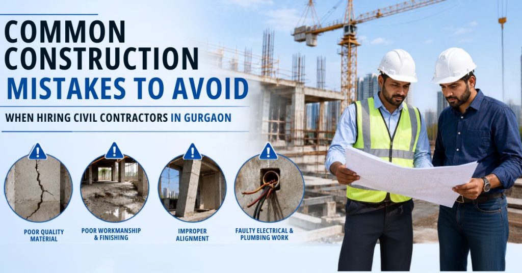 Common Construction Mistakes to Avoid When Hiring Civil Contractors in Gurgaon
 -
 Is Your Property Legally Verified? A Complete Guide to Avoiding Real Estate Fraud & Legal Issues
 -
 Living Room Design Ideas to Make a Lasting Impression on Guests
 -
 Transform Your Outdoors with the Best Landscape Architects in Delhi/NCR